
HOT Caribbean Microgrant Programme is enhancing local communities in Trinidad and Tobago and Saint Lucia to build resilience against flood risks through open mapping. Learn about community-led disaster risk reduction, youth engagement, and geospatial data’s role in enhancing disaster preparedness in the Caribbean.
The HOT Caribbean Mapping Community Microgrant Programme kicked off with awards granted to two mapping communities. The two microgrant recipients are the Geographic Information Systems Society of Trinidad and Tobago (GISSTT) and the Youth Emergency Action Committees (YEAC) of Saint Lucia. Let’s take a closer look at the microgrant and these two awardees, who shared their plans to impact their communities through this support.
These microgrants are part of the HOT Caribbean Programme, which focuses on using geospatial data to build resilience in the Caribbean. Specifically, the program supports the growth of open mapping communities by providing resources, funding, and mentorship to increase community impact.
The HOT Caribbean Mapping Community Microgrant Programme provides resources (specifically funding and technical support) with the aim of nurturing an environment for the growth and development of open mapping groups in the Caribbean region. The program offers mentorship and a microgrant of up to $2,000 USD and was launched in June 2024. The engagement of the community for raising awareness of the grant and preparing Caribbean mapping communities to participate in this initiative included sharing this information via social media, the HOT Website and an Informational Webinar held on July 10th, 2024; in which potential applicants from across the Caribbean had an opportunity to learn more about this micro-grant opportunity.
The invitation to submit proposals closed on July 16, 2024, followed by a review and shortlisting process, resulting in the selection of the two recipients. These grantees have since started work on their projects, collaborating closely with local partners.
GISSTT Mapping the Woodlands for Flood Resilience
The GIS Society of Trinidad and Tobago (GISSTT) is partnering with the Office of Disaster Preparedness and Management (ODPM) and local community members from the Woodland Flood Action Group to implement the Woodland Mapping Project. The project aims to strengthen GISSTT’s mapping community and local disaster management agencies in collecting reliable data for risk assessments through training and capacity-building. Woodland, located in southwestern Trinidad, is prone to flooding due to its low-lying terrain and poor drainage infrastructure. Floods in the area often disrupt daily life and cause economic losses.
Through capacity-building workshops, participants will learn disaster resilience best practices and contribute to data collection and mapping efforts. The project’s success could lead to replication in other vulnerable communities. Additionally, the partnership with ODPM strengthens national agencies’ ability to conduct risk assessments using open mapping data.
Priya Harnarine, Vice President of GISSTT, highlighted the importance of this partnership:
The microgrant and GISSTT’s partnership with HOTOSM have enabled us to strengthen Trinidad and Tobago’s open mapping community, especially through projects like the Woodland Mapping Project and Women-Centered Disaster Resilience in SIDS. These initiatives show how eager local communities are to participate in resilience efforts and benefit from skill-building programs. With a dedicated team of GIS professionals, disaster experts, and project managers, GISSTT continues to enrich communities through geospatial technologies. We’re also excited to collaborate with faculty and students at the University of the West Indies. We hope to bring more organizations into our expanding open mapping community.
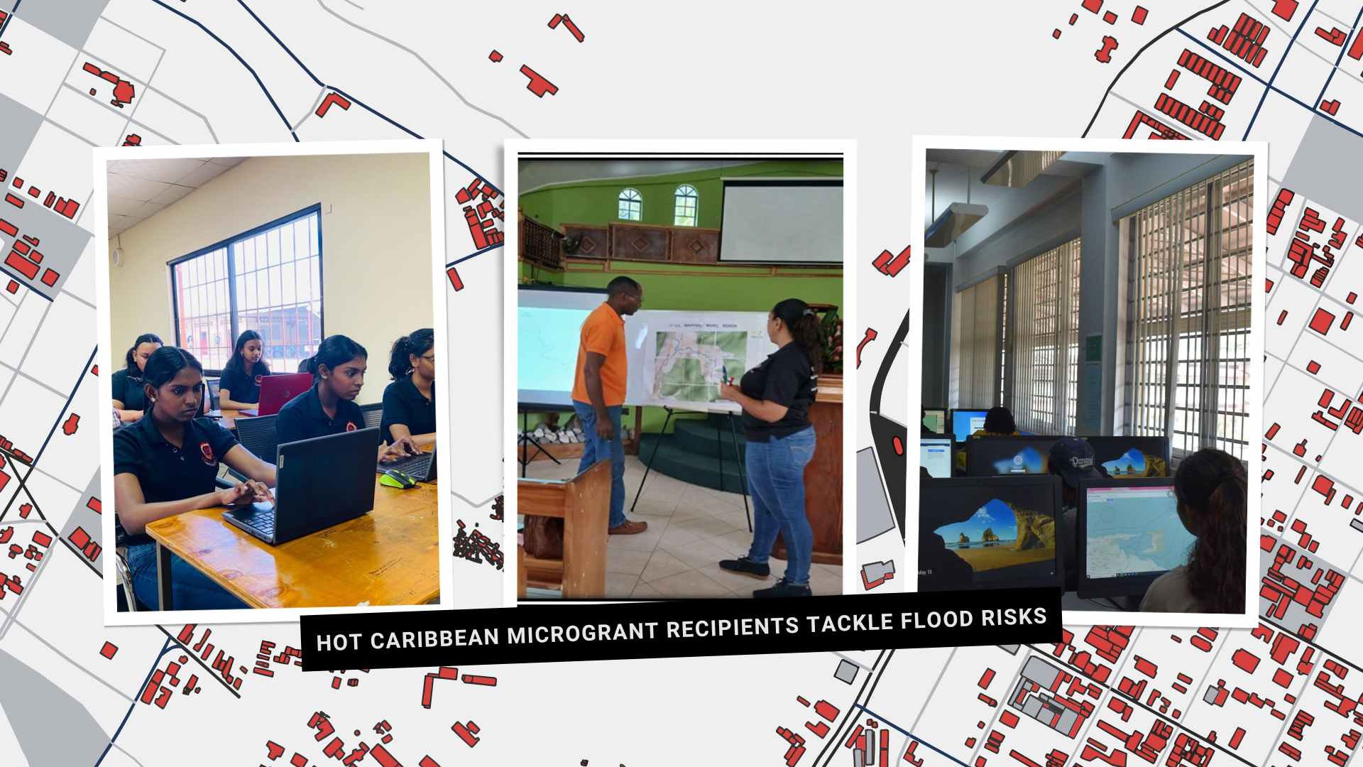
Community-Led Mapping for DRR (CLMDRR) project will involve 16 individuals: 12 from CBO and 4 youth mappers from Marc, Bexon, St. Lucia. This initiative aims to train and empower community-centered mappers on OSM. Youth mappers will share their skills and help train the 12 project participants in mapping and data collection on OSM. Field mapping sessions will be held to gather information for the community’s Hazard Vulnerability and Capacity Assessment (HVCA), which will guide future mitigation projects. A mapathon will be held at the CBO’s center to conclude the project, and the best mappers will be recognized.
Proann Francis, Project Manager of YEAC Saint Lucia, emphasized the project’s impact:
The community of Marc Bexon is highly vulnerable to flooding, as seen during the heavy rains on September 17, 2024. Thanks to the HOT microgrant, YEAC Saint Lucia will complete a mapping project to collect critical data for a Risk Assessment, which will inform future emergency response plans.
Both projects focus on mapping flood-prone areas while also building capacity among youth volunteers and local residents. HOT is excited to collaborate with these agencies in strengthening mapping communities and making them more resilient.
Coincidentally, both of these projects are focused on mapping flood prone areas in their respective countries while also building capacity among youth volunteers and residents of the area. HOT is happy to work in partnership with these agencies in strengthening mapping communities while also building more resilient communities.