Open Source Contributor Journeys into HOT – could you be the next one?

Discover the inspiring journeys of Emir and Faiz, two tech contributors making a real impact with the Humanitarian OpenStreetMap Team (HOT). From Python packages to user-centered design, their stories show how open source skills can power humanitarian change. Could you be the next to join HOT’s open source movement? Hi everyone, Petya here – Tech […]
Can low-cost drones contribute to mangrove monitoring and conservation? Testing Drone Tasking Manager in La Paz, Mexico

Drone Tasking Manager (DroneTM) is a digital public good that enables communities to generate high-quality, high resolution aerial imagery using low-cost drones. Discover its potential for community-driven mapping and its use in protecting mangroves in La Paz, Baja California Sur, Mexico. Revolutionizing Cartography with a Digital Public Good Access to aerial imagery has traditionally been […]
Fortalecimiento de Comunidades en la Conservación de Manglares: Tecnología de Drones y Colaboración Local

Descubre cómo la colaboración con comunidades locales y el uso de drones ligeros están revolucionando la conservación de los manglares en México, fortaleciendo la gestión territorial y promoviendo la resiliencia comunitaria. English version Desde 2022, el Equipo Humanitario de OpenStreetMap (HOT) ha trabajado en proyectos y respuestas a emergencias en América Latina y el Caribe, […]
The [geospatial data] have and have-nots: 15 years of bridging the divide
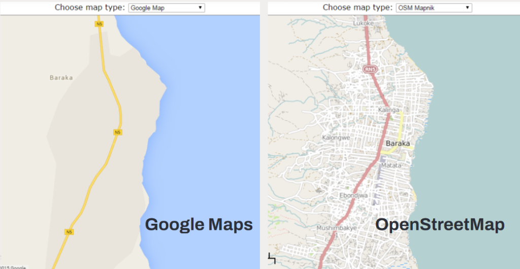
As we celebrate the Humanitarian OpenStreetMap Team’s 15 anniversary, we reflect on the role of community-generated geospatial data in solving many of the core challenges we face this century. How can our wider data-centered international community bring in voices that are often left out? Data is everywhere and can be used by everyone to improve […]
Lebanon’s Recovery: Mapping a Path from Rubble to Resilience
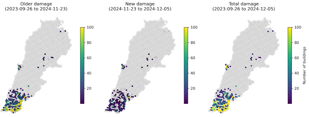
Lebanon is grappling with severe destruction and displacement from recent conflict. A data-driven approach using mapping is essential for effective humanitarian aid and long-term recovery. By leveraging mapping tools and community involvement, reconstruction can better address local needs and ensure a sustainable future. Lebanon, a nation already grappling with a multitude of crises, has been […]
Building DroneTM: A Digital Public Good Solution To Democratize Drone Mapping
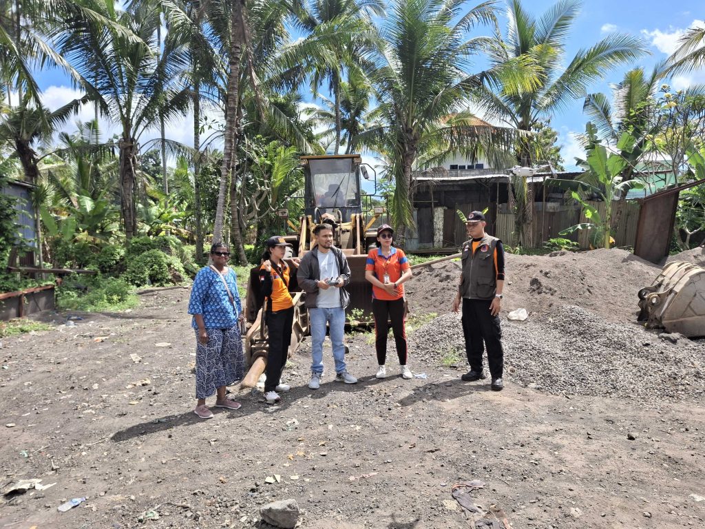
Guest blogger Niraj Adhikari, from our partner NAXA, takes us through the motivations that led him to become a geospatial software developer, as well as the highs and lows of developing a groundbreaking product such as DroneTM, making the vision of accessible and community-driven drone-based mapping a reality. For as long as I can remember, […]
Staff Spotlight Series: Kennedy Jomokela
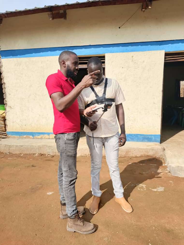
Each quarter, we feature one of our all-star staff members in a Spotlight Series. Staff featured in this Series have been peer-nominated for their superb performance and values-driven work. This quarter, we spotlight Kennedy Jomokela, Project Associate at the Eastern and Southern Africa Hub. What’s the most unique part about working at HOT? One unique […]
Introducing Street-Level Imagery Projects to MapSwipe4Web!
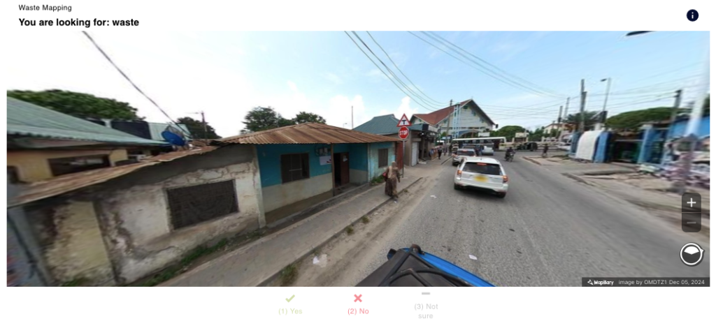
MapSwipe4Web is launching a new street-level view! Ready to know the details? Read ahead: Cover image: Street-level view of Avenida Constituyentes, Querétaro. Source: Mappillary. CC BY-SA 4.0 Big news, MapSwipers! MapSwipe is stepping up its game with the debut of an exciting new project type: street-level imagery projects! Thanks to funding from the Humanitarian OpenStreetMap […]
Strengthening Communities in Mangrove Conservation: Drone Technology and Local Collaboration

Discover how collaboration between local communities and the use of lightweight drones are revolutionizing mangrove conservation in Mexico, strengthening territorial management, and promoting community resilience. Versión en Español Since 2022, the Humanitarian OpenStreetMap Team (HOT) has worked on projects and emergency responses in Latin America and the Caribbean, focusing on coastal zone issues. One of […]
Humanitarian Data Improvements in Sudan through OpenStreetMap
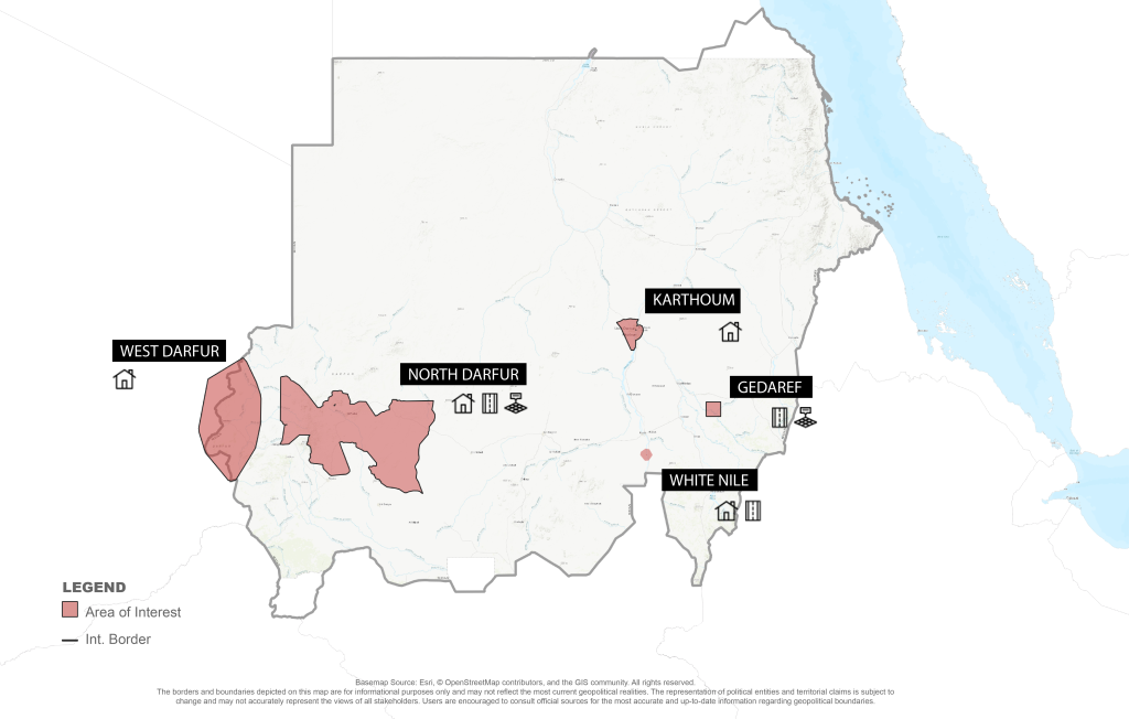
Humanitarian mapping in Sudan has been improving data quality in OpenStreetMap (OSM) in otherwise uncovered areas. For those interested in using this OSM data, Humanitarian OpenStreetMap Team is making it easier than ever to find what data (and where!) in Sudan has been updated. Geospatial Data Creation in Response to Crisis Since its creation over […]